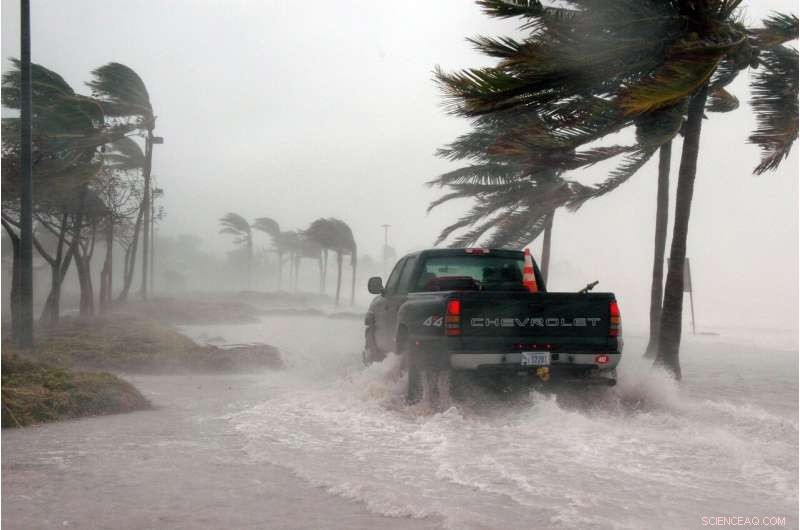
O que sabemos e não sabemos sobre como as mudanças climáticas afetam furacões como Ian

Crédito:Pixabay/CC0 Public Domain
É uma pergunta que segue qualquer desastre natural, especialmente furacões monstruosos como Ian:isso foi causado pela mudança climática?
Quando solicitados, cientistas como Kevin Reed geralmente reagem. A maioria dos pesquisadores concorda que não é válido apontar para uma única tempestade e dizer que ela foi "causada" pelo aquecimento do mundo. Muitas variáveis.
"Essa é uma pergunta realmente difícil de responder. Não há 'como seria setembro de 2022 sem as mudanças climáticas?' Não temos isso", disse Reed, professor associado da escola de ciências marinhas e atmosféricas da Stony Brook University.
Mas há um consenso crescente de que o aumento do nível do mar e as temperaturas mais altas nos últimos cem anos já impactaram tempestades como Ian, que assolaram a Flórida na semana passada, e podem continuar a fazê-lo no futuro. No mínimo, clima mais quente significa oceanos mais quentes, que alimentam a força dos furacões.
"Vivemos em um mundo que está mais de 1 grau mais quente (Celsius), não há dúvida de que os furacões mudaram em alguns aspectos por causa das mudanças climáticas", disse ele.
Tom Knutson, cientista sênior da NOAA que estuda clima e furacões, disse que os cientistas estão mais confiantes em perceber o que mudou nas tempestades no mundo moderno. Mas menos ainda sobre ser capaz de conectar essas mudanças às mudanças climáticas. Prever o que o futuro pode reservar é ainda mais difícil.
Isso porque os furacões e os padrões climáticos globais são diabolicamente complicados. Algumas das mudanças na atmosfera e tempestades, por exemplo, podem ser atribuídas aos altos níveis de poluição física do ar, além dos gases de efeito estufa, expelidos na atmosfera.
A tecnologia de rastreamento de tempestades também melhorou muito nos últimos séculos. Os cientistas concordam que agora estamos pegando muito mais "tempestades de lixo" - ciclones fracos e de curta duração - do que nunca. Isso pode distorcer os dados, e é por isso que a maioria dos cientistas é cautelosa ao traçar uma linha direta entre um globo mais quente e os números de furacões.
“É uma imagem bastante complexa e, aumentando a complexidade, estamos inferindo muitas dessas coisas de modelos climáticos que têm incerteza”, disse Knutson. "Temos de ter cuidado."
Aqui é onde a ciência está em várias frentes:
Provável maré de tempestade mais alta Os níveis do mar perto do sul da Flórida já subiram cerca de 20 centímetros desde 1950, de acordo com dados do medidor de marés da NOAA. Isso significa que a água está começando de um nível de base mais alto, permitindo que a onda de furacões atinja alguns centímetros mais alto e cubra mais terreno.
Os pesquisadores esperam que o aumento do nível do mar acelere à medida que as temperaturas mais altas fazem com que as camadas de gelo polares derretam mais rapidamente. Over the next century, South Florida can expect to see more than three feet of sea level rise, according to estimates from the UN Intergovernmental Panel on Climate Change (IPCC). That will push storm surge higher when hurricanes roll through coastal communities.
One 2020 study modeled what 21 hurricanes that struck between 2000 and 2013 might look like under the climate conditions expected in 2100. The researchers estimated that, on average, floods would have been about 30% worse and covered about a quarter more land.
More extreme rainfall One of the most straightforward connections between climate change and hurricanes is rain. Like anyone who's experienced humidity knows, warmer air holds more moisture.
For every 2 degrees Fahrenheit of warming, there is about 8% more water in the atmosphere, and the world has warmed at least 2 degrees Fahrenheit since pre-industrial times.
So perhaps it's no surprise that one study of the 2020 hurricane season found an average 8% increase in 3-day rainfall totals for hurricanes, and a 5% increase for tropical storms.
The lead author, Stony Brook's Reed, said they also found that a hotter planet increased the rate of rainfall. In the 2020 season, three-hour rainfall rates would increase 10% or higher for tropical storms and hurricanes.
"If you experience a similar storm in the future it's going to rain more because of climate change," he said. "If you had 30 inches of rain, you could say over 2.5 inches of that rain was due to climate change, meaning it would not have rained as much if we hadn't heated the planet."
Reed and his colleagues also produced a rapid study of Hurricane Ian on Thursday that suggested a 10% increase in extreme rain rates due to human-caused climate change.
This body of research, known as attribution science, looks to answer the question of how climate change influenced a particular storm. In Reed's case, he and his colleagues load up a powerful supercomputer weather model with the exact track and data from a modern-day storm, then re-set the clock back to the temperature and atmospheric conditions of the 1850s.
The clearest change they see is the storms are far less wet when set in the past.
Getting stronger faster One of the most dangerous features of hurricanes is rapid intensification, which is when a storm's top wind speeds increase 35 mph or more in a single day. It's also difficult to predict so when a storm suddenly strengthens near the shore, coastal communities have little time to prepare or evacuate.
Early studies suggest climate change has already made rapid intensification more common. A 2021 IPCC report found that "the global frequency of [tropical cyclone] rapid intensification events has likely increased over the past four decades" and added that researchers have "medium confidence" that "none of these changes can be explained by natural variability alone."
Researchers can say with much more certainty that the conditions that lead to rapid intensification are becoming more common. Sea surface temperatures are rising at a rate of 0.14 degrees Fahrenheit per decade, according to NOAA, and atmospheric moisture is increasing between one and two percent per decade, according to the IPCC. Both of these factors may give future hurricanes more fuel to turbocharge their growth.
Meanwhile, NOAA and Columbia University researchers predict that climate change will weaken vertical wind shear, an atmospheric feature that can pump the brakes on rapid intensification.
"We've seen multiple studies that show the conditions in the North Atlantic basin are providing more opportunities for storms to intensify," said Kieran Bhatia, a former climate researcher at Princeton University who is now a vice president for the climate change perils advisory team at the insurance broker Guy Carpenter.
Fewer hurricanes, but stronger Climate change might make hurricanes more intense but less frequent.
Reliable global records of hurricane intensity only go back about four decades, when weather satellites began scientists to accurately estimate the strength of storms. In the years since, hurricanes appear to be getting stronger, according to a 2020 paper from researchers at NOAA and the University of Wisconsin. They found that the likelihood that a cyclone will reach Category 3 wind speeds—the threshold to be designated a "major hurricane"—has risen about 25% since 1979, as extra heat in the oceans and atmosphere gives storms more fuel to grow.
But even as climate change makes storms stronger, scientists believe it is weakening the ocean currents that help cyclones form in the first place—particularly the Atlantic meridional overturning circulation (AMOC), which pulls warm surface waters from the tropics across the Atlantic Ocean. The IPCC's 2021 report says the AMOC, which also powers the Gulf Stream, is "very likely" to weaken over the 21st century.
As a result, hurricanes may become less frequent. A July paper published in
Nature Climate Change estimated that tropical cyclones formed 13% less often in the 20th century than they did between 1850 and 1900. Although hurricane data before the satellite era is spotty, the international team of researchers combined real world observations with simulations from climate models to fill in the gaps and estimate the number of hurricanes that may have formed from 1850 to 2012.
"A string of consecutive seasons with Category 5s, that's something more consistent with what we'd expect in a warmer climate ... as opposed to a higher number of storms," Brian Soden, a professor of atmospheric sciences at the University of Miami's Rosenstiel School of Marine and Atmospheric Science, told the Miami Herald in 2020.
Slower and wetter storms Jim Kosin, a climate scientist at the NOAA Cooperative Institute for Meteorological Satellite Studies in Madison, Wisconsin, published a paper in 2018 that suggested that tropical storms and hurricanes around the world had slowed down about 10% between 1949 and 2016, and hit the brakes even harder over land.
It was met with some criticism in the scientific community, but he followed it up with another research paper with NASA's Timothy Hall in 2019 that narrowed in on the slowdown of storms near the North American coast since 1950.
They found that hurricane forward speed has decreased since 1900, which can lead to even more rainfall and flooding as a storm stalls over land.
"More study is needed to determine how much more slowing will occur with continued warming. Still, it's entirely plausible that local rainfall increases could actually be dominated by this slowdown rather than the expected rain-rate increases due to global warming," Kossin told a NOAA blog.
Knutson, with NOAA, called it "the most convincing evidence of a trend I've seen so far."
But he cautioned that just because the trend was observed doesn't automatically mean climate change is to blame. "That's an open research question."
More landfalls may be in future In the past, many storms at sea went undetected unless reported by vessels unlucky enough to encounter them. But good records go back a century or more on ones that make shore.
New research by Knutson, based on running past data into a computer model, projects what might happen to hurricane paths in the future if global warming continues unchecked. He found that while the number of storms making landfall hasn't really changed that much in the last century, an increasing fraction could in the future could.
Combined with other research suggesting that fewer but more powerful storms could form in the future, Knutson said his findings suggest that cities are in for fewer, but increasingly intense hits.
"It's kind of several effects cutting in different directions," he said.
Ever the careful scientist, Knutson also cautioned that his work was only a prediction.
"That's in the model. We'll see what happens in the real world," he said.
+ Explorar mais Study finds that climate change added 10% to Ian's rainfall
2022 Miami Herald.
Distributed by Tribune Content Agency, LLC.
